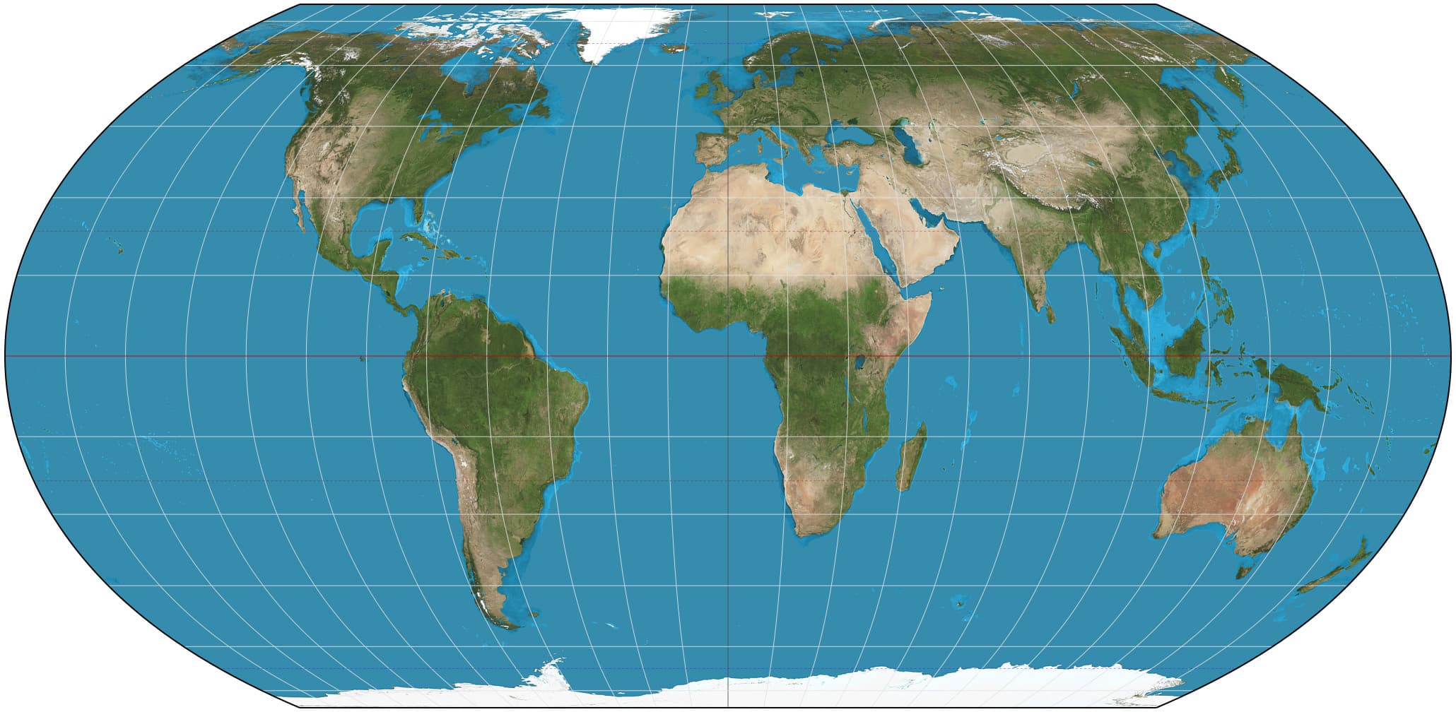
For 450 years, the map hanging in most classrooms has been quietly lying about Africa. On Friday, the United Nations voted to do something about it. Out of 193 member states, 164 said yes. One said no.
The Vote
The "Correct the Map" resolution, sponsored by Togo on behalf of the African Union and backed by the Bahamas, passed 164 to 1, with six countries — Estonia, Georgia, Lithuania, Moldova, Serbia, and Ukraine — abstaining. The United States cast the only vote against it.
Maps shape our understanding of the world. A fair map does not change the geography of the world; it changes how we see the world.
Robert Dussey, Togo's Foreign Minister
What the Map Actually Gets Wrong
The world's most widely used map, the 16th-century Mercator projection, distorts landmasses the further they sit from the equator — shrinking countries near the equator and inflating countries near the poles. The visual result: Greenland looks roughly the same size as Africa on a Mercator map. In reality, Africa is about 14 times larger. The resolution encourages governments, schools, and tech companies to switch to the Equal Earth projection instead, which keeps continents at their true relative proportions, for any use where size actually matters. It doesn't touch Mercator's continued use for actual navigation, where the projection still works fine.
Why the U.S. Voted No
The U.S. deputy representative to the UN Economic and Social Council didn't just vote against the resolution — she used the floor to dismiss the entire premise. "Resolutions like this and the ideological agenda they promote are barnacles on our work here, and the reason this institution is losing its credibility," she said, adding that the UN was debating "map projects from the 16th century" instead of "genuine problems of international peace, prosperity, or good relations." The U.S. statement tied the map resolution to a "much larger and more radical ideological project" around reparations and what it called "cognitive justice."
The Irony Sitting Right Next to This Vote
Here's the part that's hard to miss: the same U.S. administration that called a map correction "not important" enough to support has spent the past year renaming geography to flatter itself. In January 2025, an executive order renamed the Gulf of Mexico the "Gulf of America" — and both Google Maps and Apple Maps rolled out the change for U.S. users within weeks. Just last month, a follow-up order told Interior Secretary Doug Burgum to rename Lake Ontario "Lake America," and Google confirmed it would apply the same treatment. So a map change that puts "America" onto a lake shared with Canada gets fast-tracked through Big Tech in weeks. A map change that gives Africa its actual, factual size gets voted down as ideology. One rewrites geography to center the U.S. more; the other corrects geography to represent everyone else more accurately. Only one of those got called "radical."
What Happens Now
The resolution isn't legally binding — no country or company is required to drop Mercator. But it carries real weight as a signal: hours before the vote, France's foreign minister announced Paris would abandon Mercator for its own official maps, aligning with the African-led push. Whether other governments and mapmakers follow is now a question of momentum, not law — and momentum is exactly what a 164-1 vote is built to create.